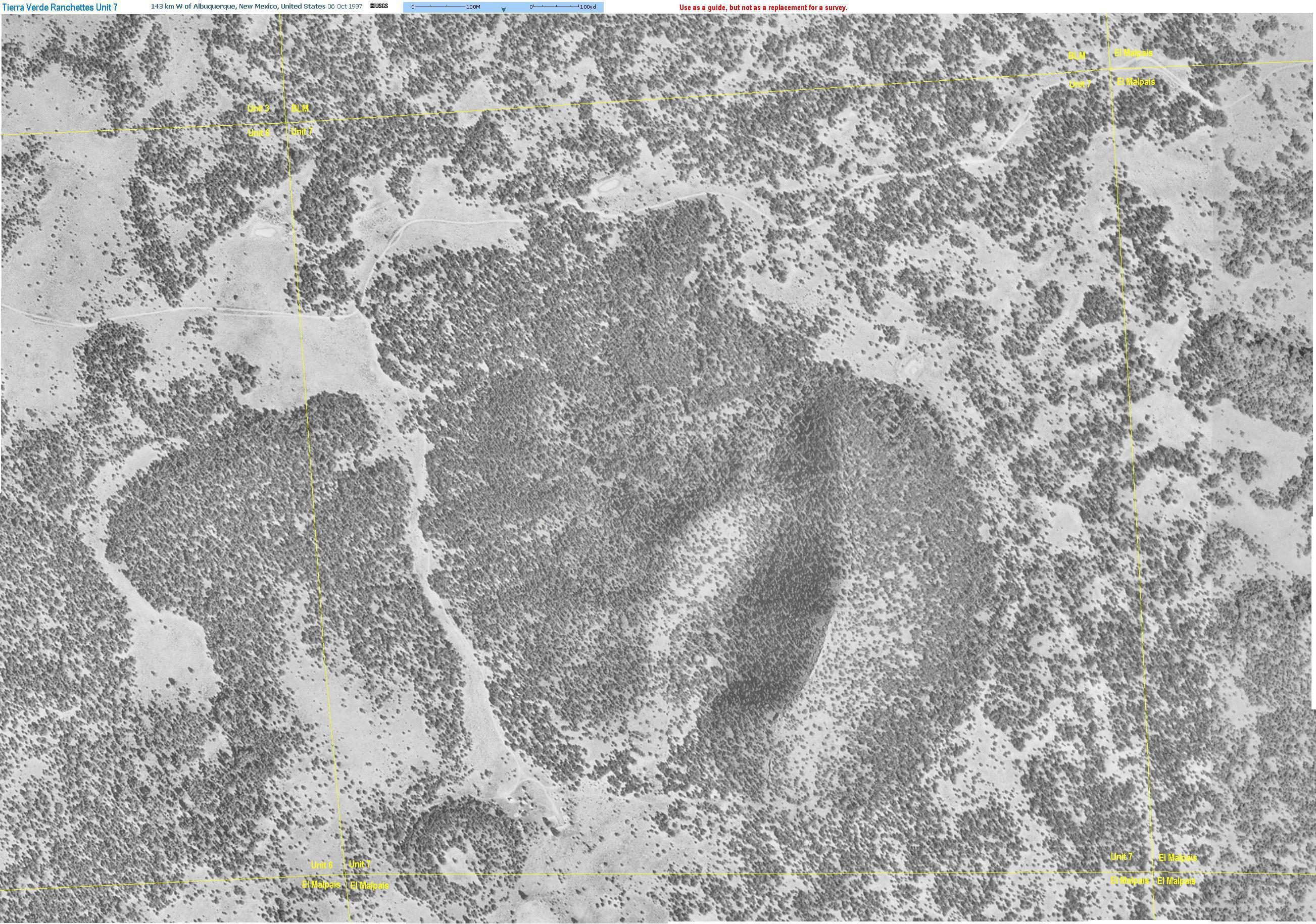
| Maps, GPS coordinates, aerial photos and information on locating the Tierra Verde Ranchettes. |
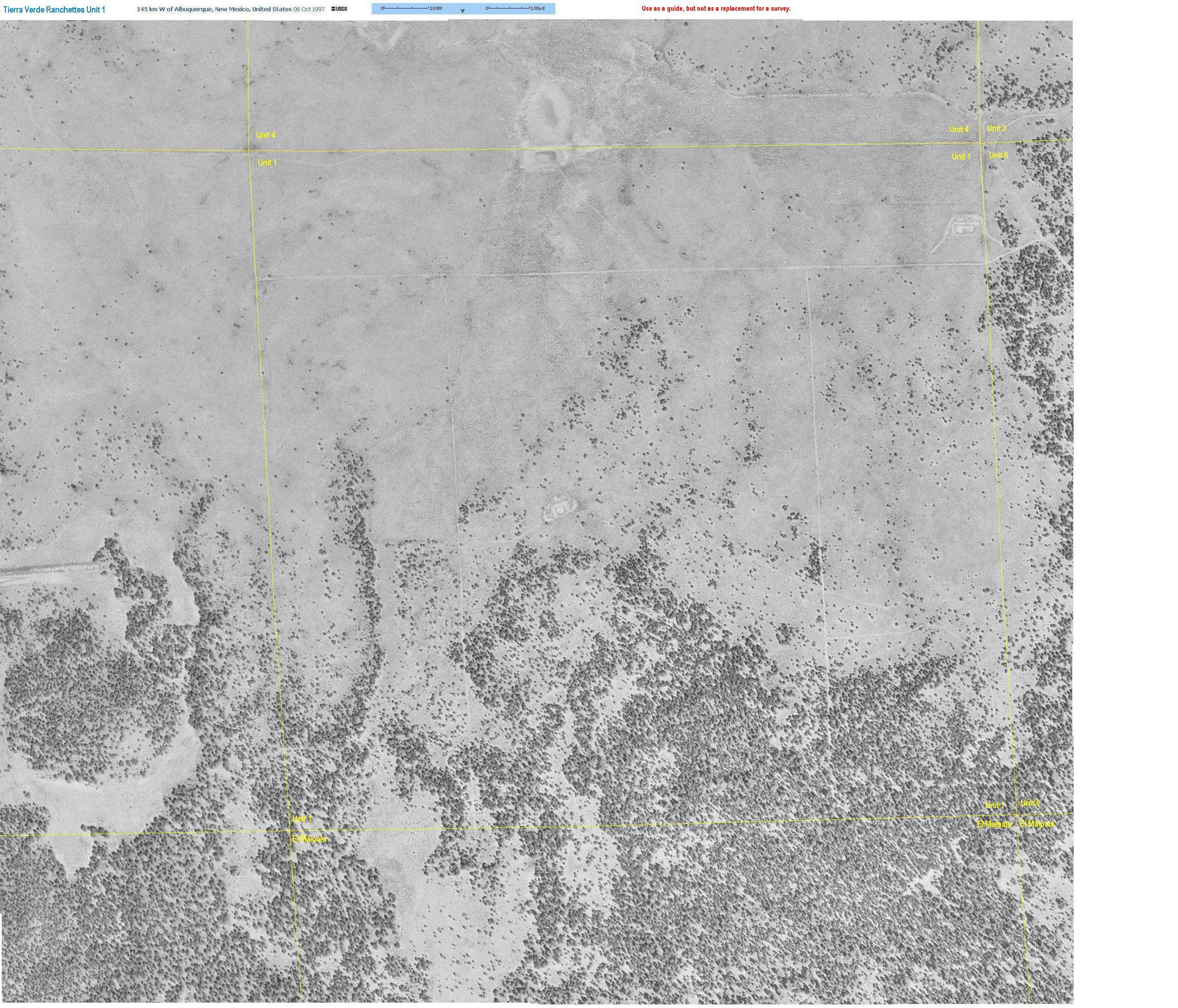
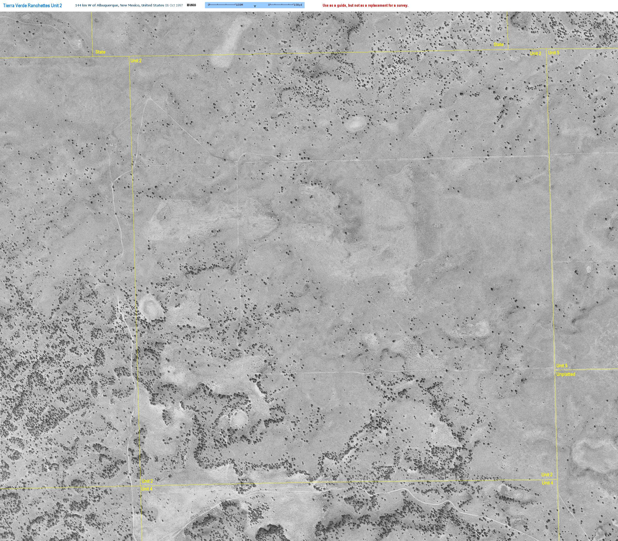
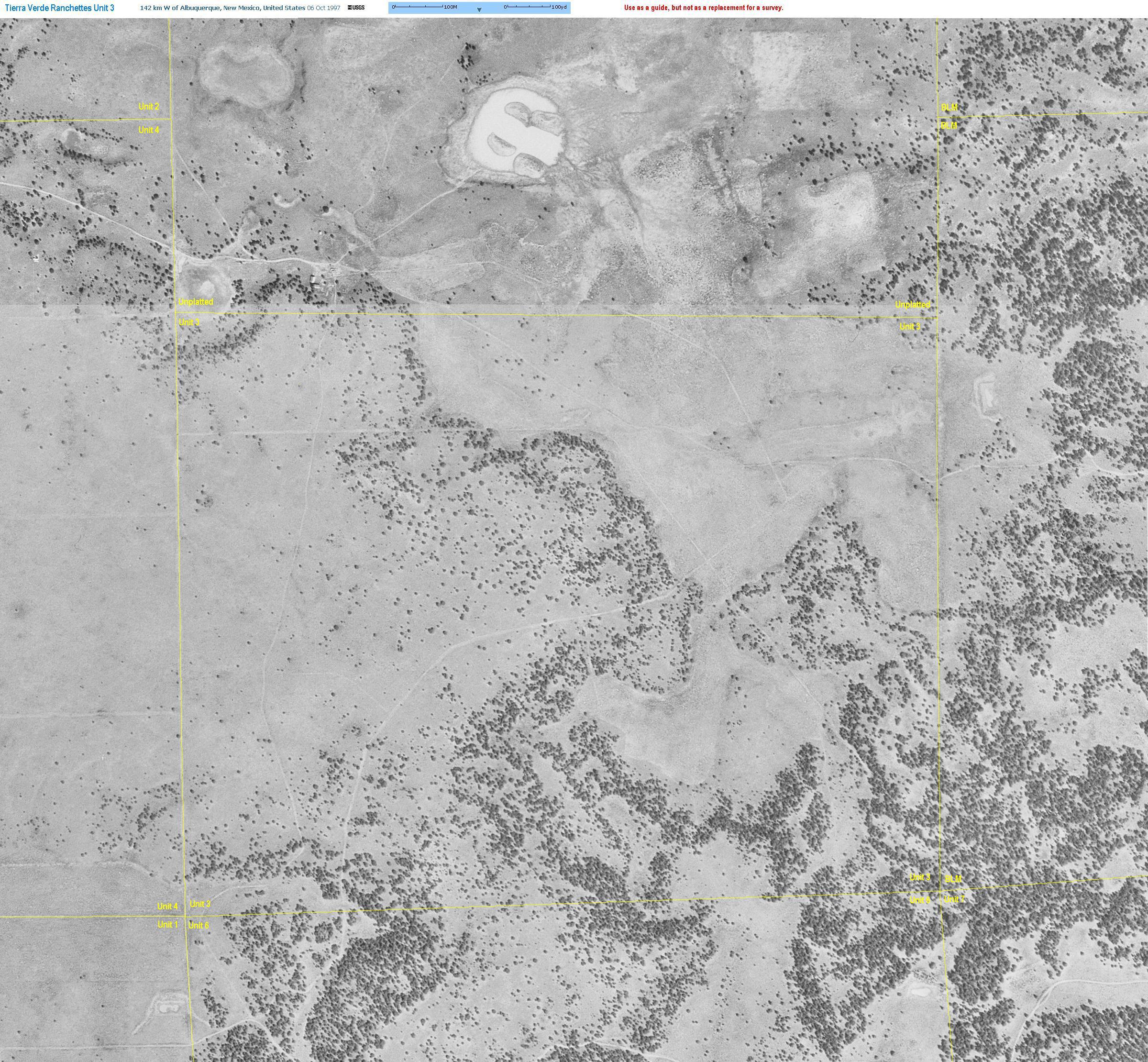
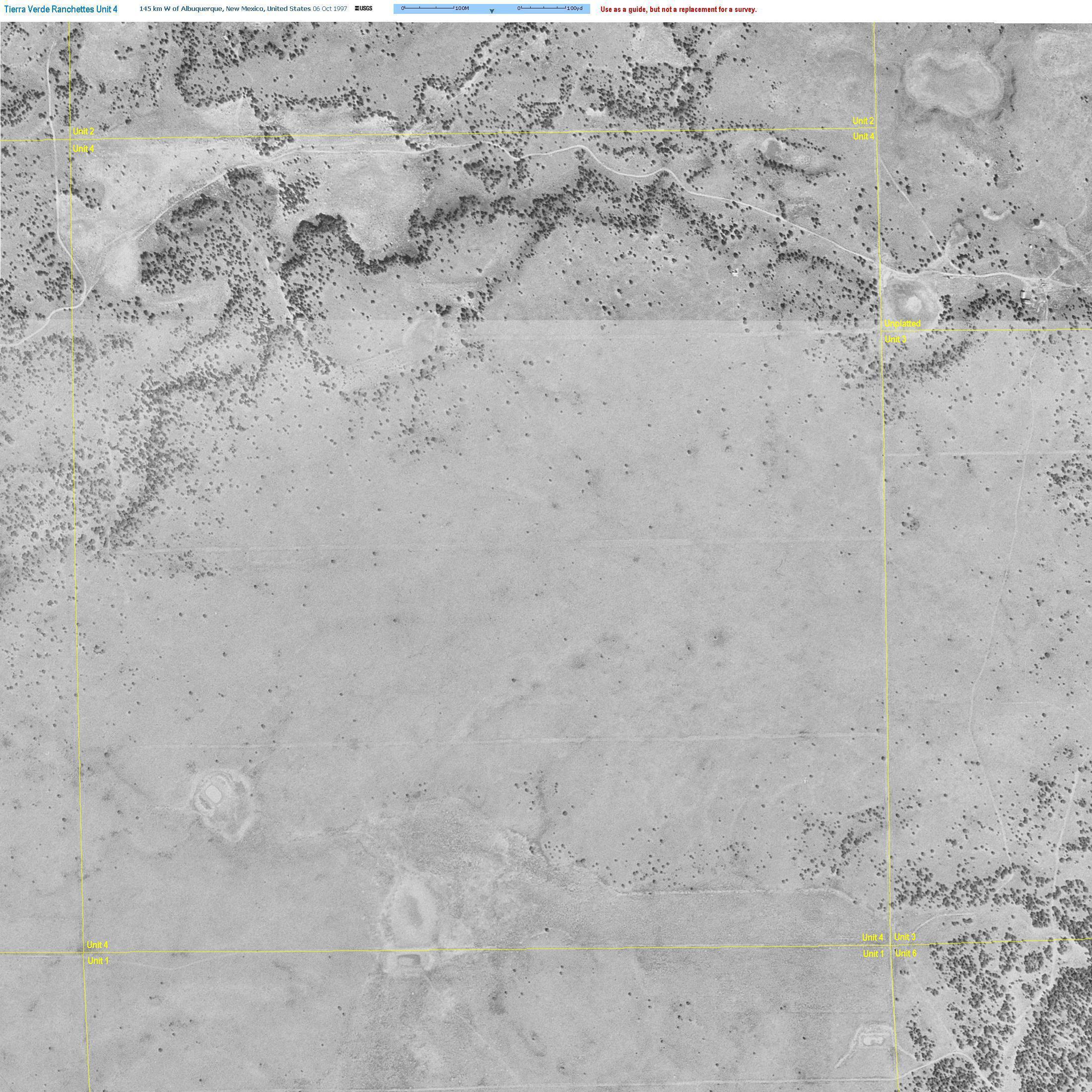
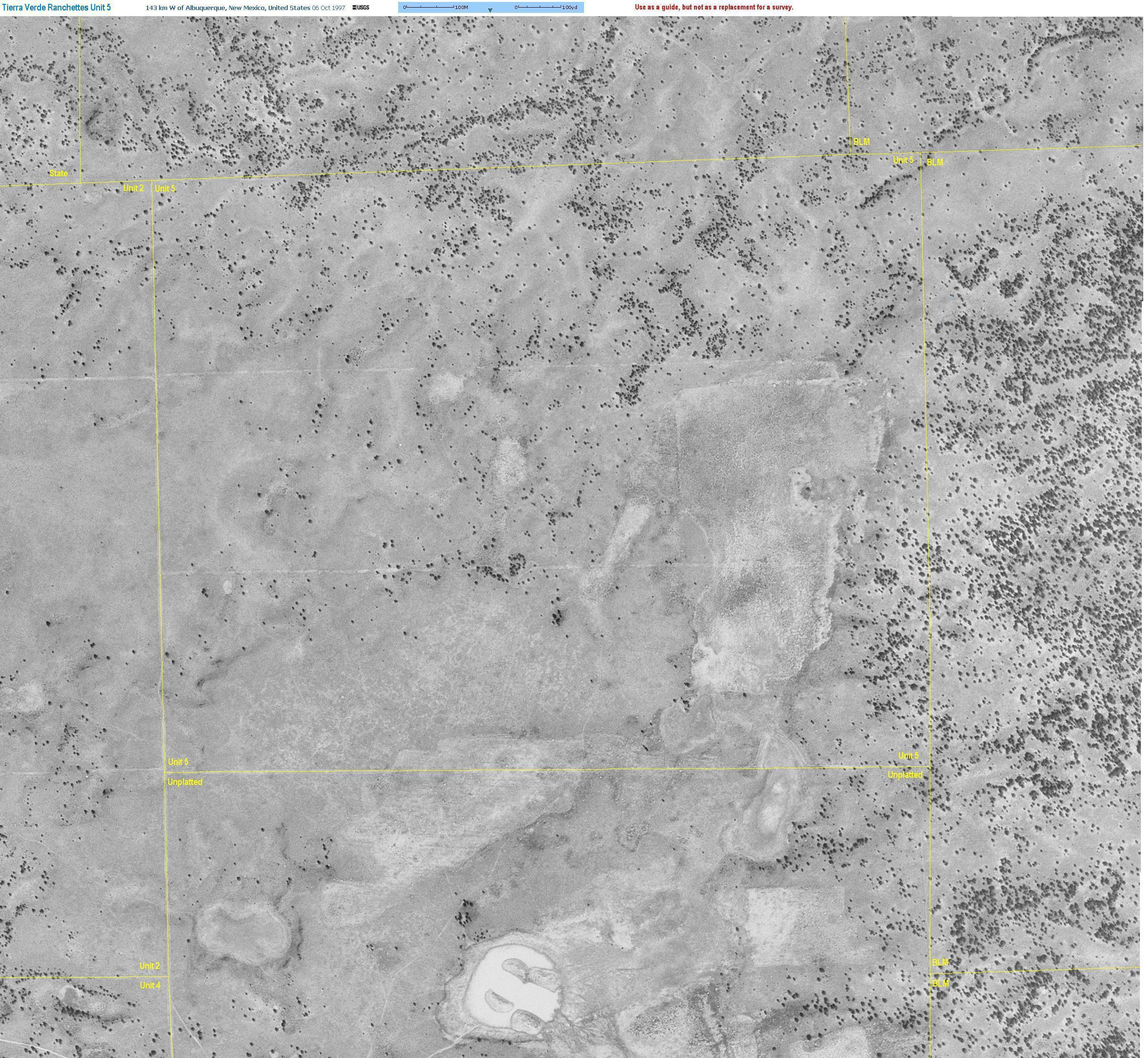
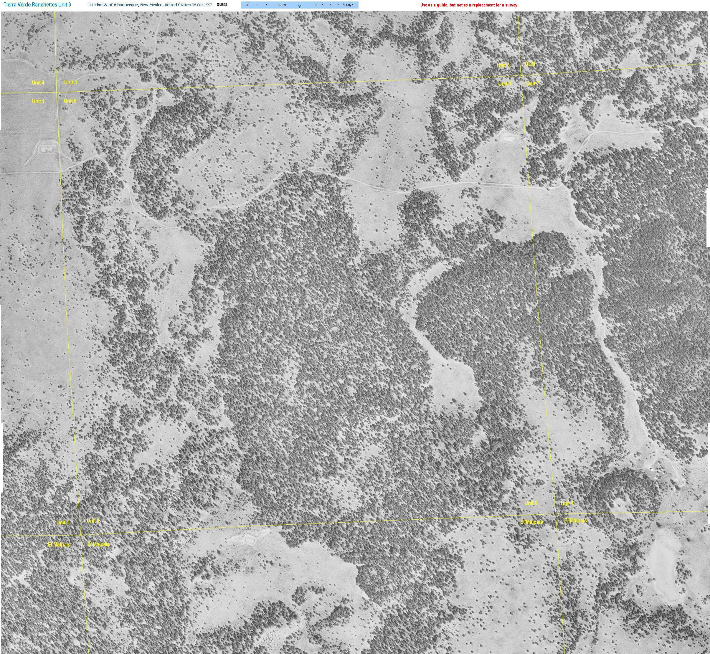
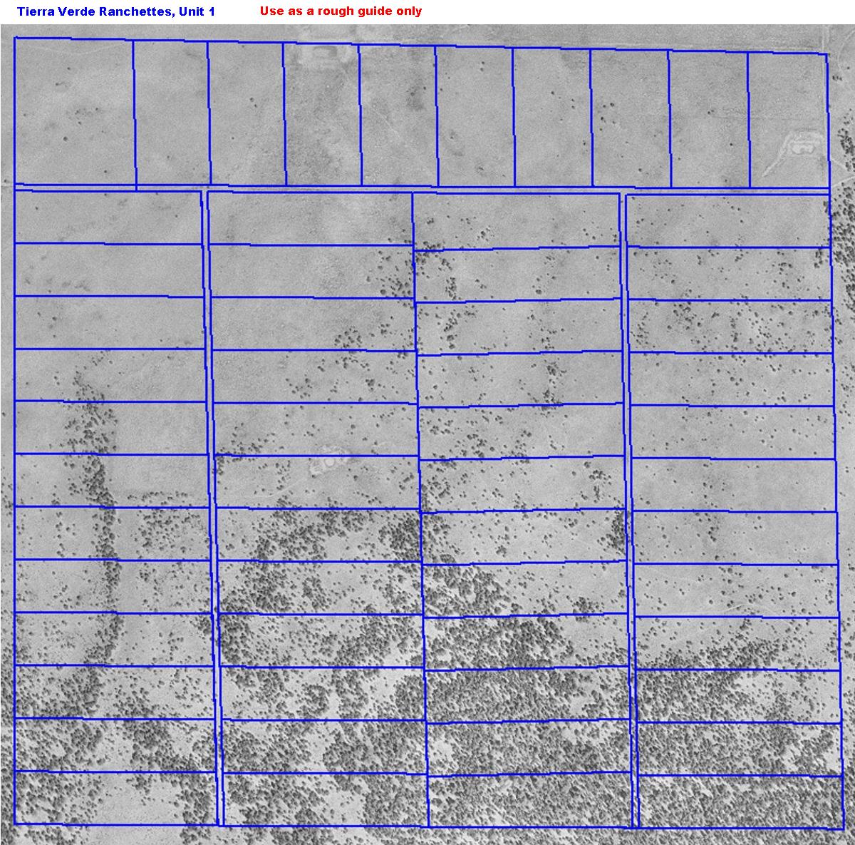
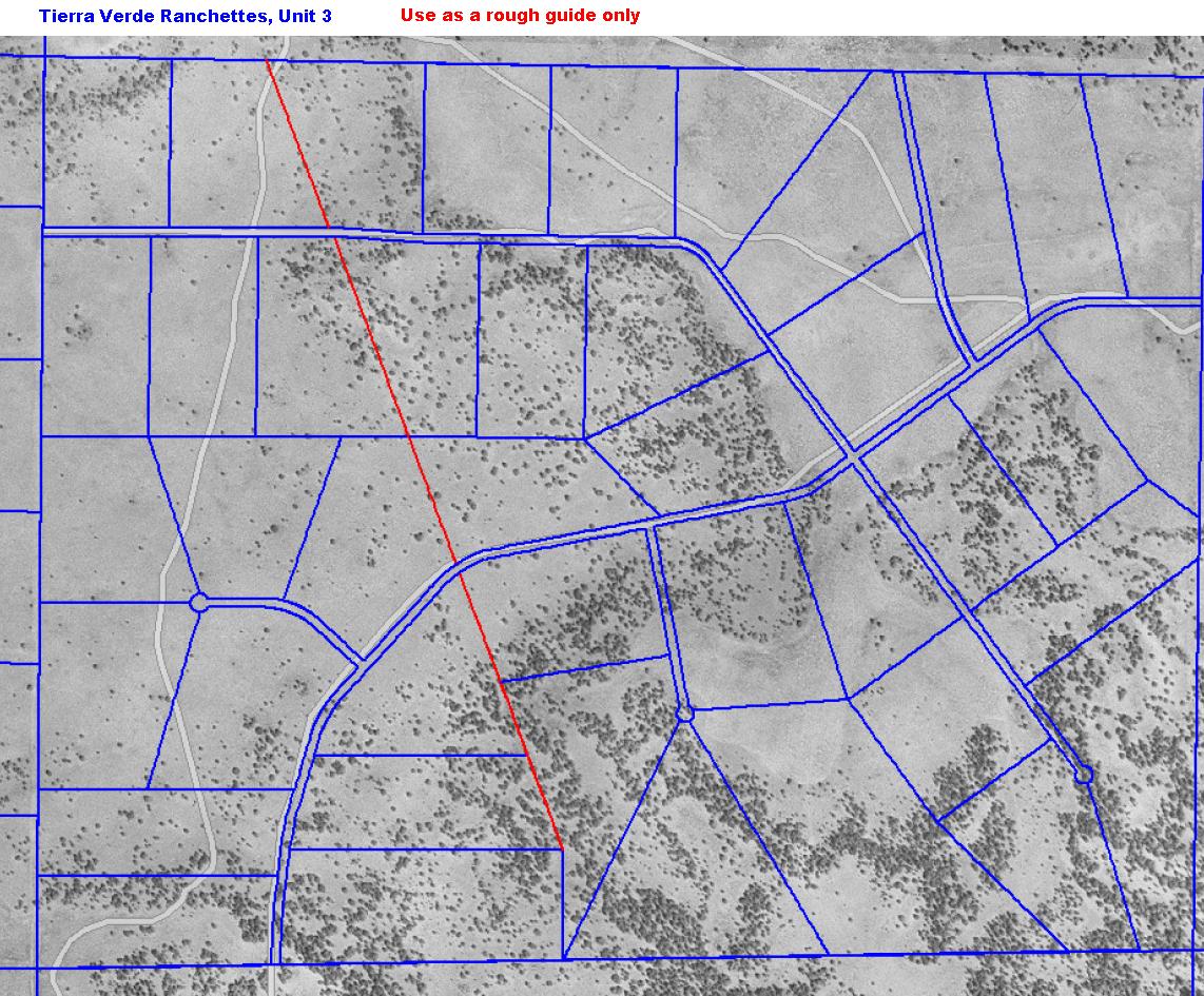
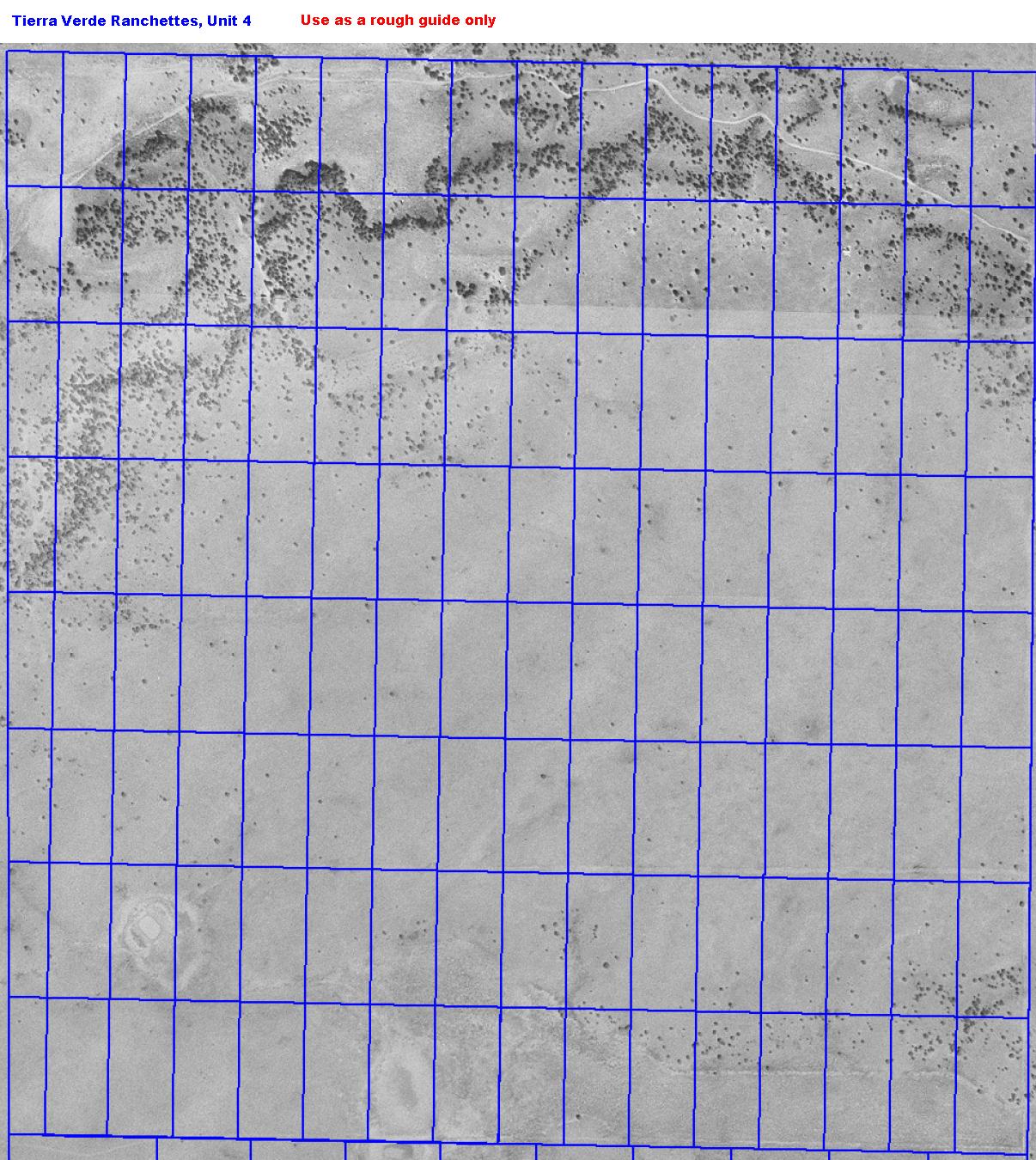
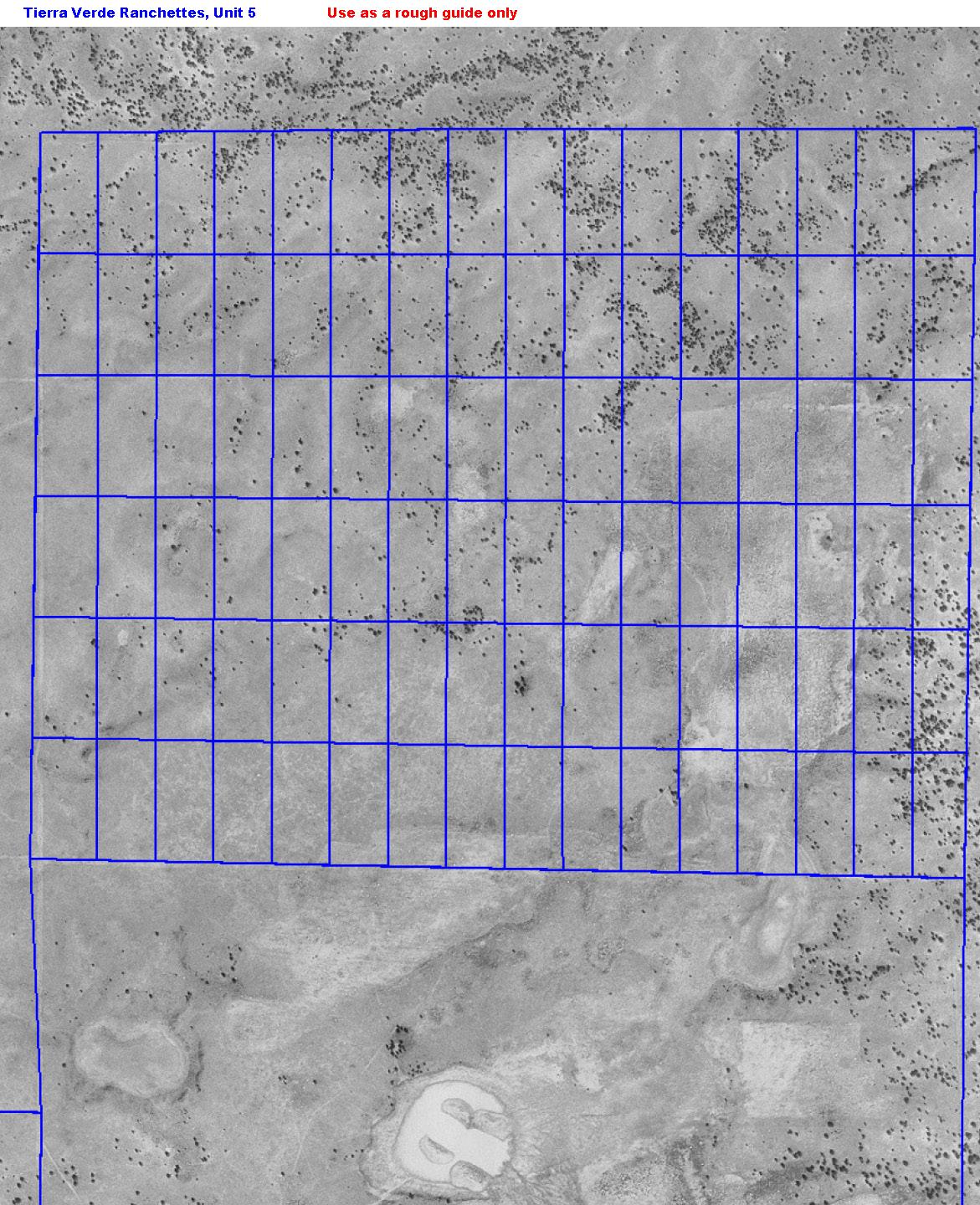
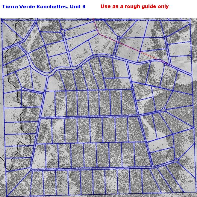
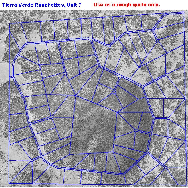
| High Resolution Aerial Photo of the Units |
| Select the unit below. The unit boundaries have been added to the aerial photos. The photos are best viewed with the browser set to not resize the photo. |
| Driving Directions with GPS Coordinates |
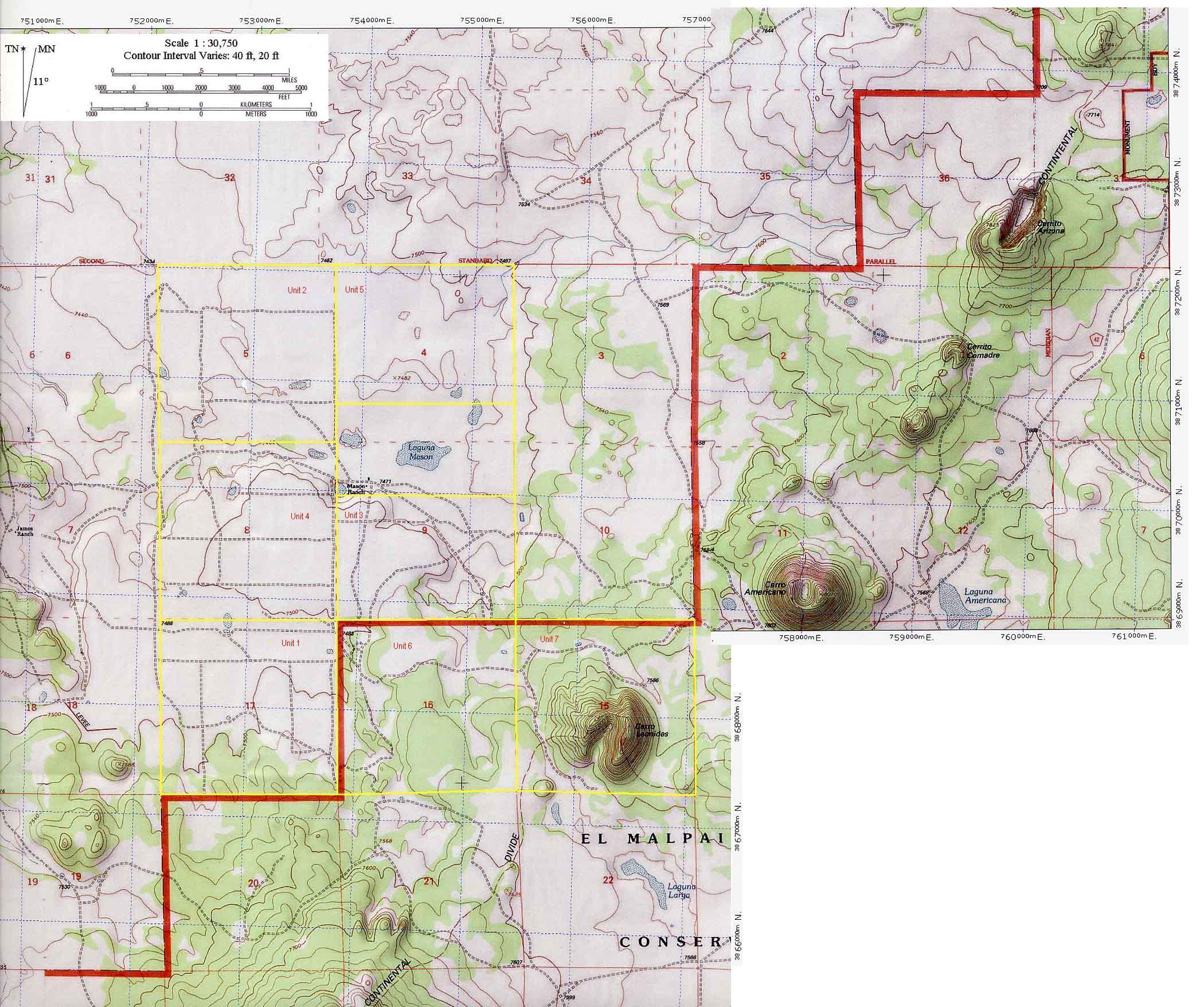
| Tierra Verde Ranchettes Maps |
 |
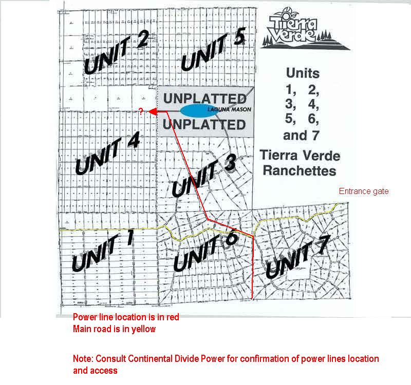
| Plat Map. Entrance gate is marked, primary access road is in yellow and the approximate power line location is in red. |
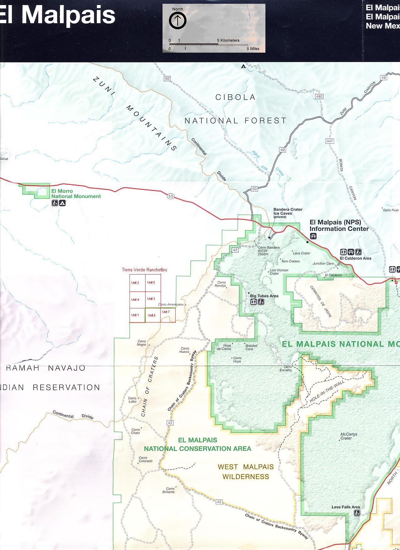
| El Malpais National Monument Map. County road 42 is clearly visible. The Tierra Verde access road leaves Road 42 by Cerro Americano and passed to the South. Tierra Verde is approximately 1 mile to the West of Cerro Americano and is marked on the map. |
| Topographical Map. The Tierra Vede units are labeled and marked in yellow. |
 |
| Tierra Verde Toolkit |
 |
| Click here for the driving directions, distances and GPS coordinates to reach the subdivision. The plat maps, topo maps and aerial photos can be used to navigate within Tierra Verde. |
| BLM Map. The New Mexico Fence Lake BLM map, 2002 edition. The Teirra Verde units are markde in red. |
| [an error occurred while processing this directive] |
 |
| Area Maps |
| El Malpais Map. PDF map of this national park which is adjacent to Tierra Verde. |
| Bluewater Lake Park. PDF map of this state park in the area. |
| New Mexico in 1895. Map of New Mexico in 1895 for historical interest. |
| Cibola National Forest. PDF map of the Cibola National Forest. |
| Navajo Lake Park. PDF map of this state park which is to the north of Tierra Verde on the New Mexico-Colorado border. It is the 2nd largest lake in New Mexico. |
| Chaco Culture National Historic Park PDF map of this national park. |
| Chaco Park Area PDF map of this area of this national park. |
| High Resolution Plat Maps |
| Replats |
| Unit 6_7 Replat 1989 (unfiled) |
| Unit 6_7 Replat 1994 (unfiled) |
| Original Plat Maps |
| Survey Maps |
| Tierra Verde Ranchettes Documents |
| Restrictive Covenants |
| Original Disclosure Statement |
| Unit 1 Unit 2 Unit 3 Unit 4 Unit 5 Unit 6 Unit 7 |
 |
| Aerial Photos of the Units: |
| Photos with lots approx. marked: |
| (high resolution) |
| (high or medium resolution) |